Reliable connectivity has become a cornerstone of modern agriculture and forestry, driving the adoption of advanced technologies that transform operations. By enhancing information gathering, communication, productivity, and sustainability, reliable rural connectivity help farms to innovate and thrive.
As agricultural businesses increasingly embrace IoT and integrated IT for precision farming, remote monitoring/surveillance, and resource optimisation; reliable high-speed internet infrastructure has become essential. However, significant connectivity challenges persist in many rural areas, limiting access to critical market information, the latest techniques, and effective on- and off-site communication channels.
This article therefore examines Low Earth Orbit (LEO) satellite technology as a high availability service for bridging rural connectivity gaps, explores complementary connectivity technologies, and provides some practical guidance for implementation in agricultural settings.
Current States of Rural Connectivity
Example Coverage Landscapes in the UK and EU
Rural connectivity varies significantly across regions and countries. The following table, however, summarises the current coverage in two representative European markets:
| Country | Rural 5G Coverage | Rural Fixed Broadband |
| UK | Granular 5G data is available in Ofcom’s Connected Nations 2024 interactive report ¹ | Full-fibre (FTTP): 52% of rural homes (Jul 2024) ¹
Gigabit-capable: 58% of rural premises (Jan 2025) ¹ |
| Spain | 80.01% of rural population covered by 5G (Jun 2024) ²
3.5 GHz band: 23.21% of rural population ² |
≥100 Mbps: 87.87% of rural households ²
≥1 Gbps: 83.92% of rural households ² |
As a result of the shortfalls and unreliability in some countries, many rural areas therefore currently rely on outdated and slower network infrastructures. Transitions to fixed line or new mast deployments/high-speed connections being complex and costly.
2G/3G Network Transitions
One aspect of mobile communications that may trouble rural operator/operations is the advancing sunset of 3G and 2G mobile services. While sunsetting 3G and 2G, does not inherently worsen rural coverage in the long run, gaps in deployment will exist.
For example, in the UK and across the EU, mobile network operators are re-farming the 2G/3G spectrums to expand 4G/5G services. As a result, regulators expect no long-term reduction in coverage. This, despite the shorter physical ranges in many types of 4G/5G high bandwidth technologies that require higher frequency and fibre-to-the-mast to operate effectively. It should be noted, therefore, that LTE and 5G narrowband IoT technologies, while suitable for long-life battery powered sensors may not be suitable for complex agricultural IT operations.
The main near-term risk is to older handsets and legacy telecare/IoT devices that lack 4G/VoLTE support, which require planned migration. The real determinants of rural connectivity remain site build-out (e.g., the Shared Rural Network in the UK), low-band spectrum usage, and backhaul infrastructure, rather than the continued operation of 3G networks.

The Connectivity Solutions for Agricultural Operations:
To overcome infrastructure limitations and economic constraints, a range of innovative connectivity service have emerged over time that can solve distinct problems and therefore require consideration:
Technology Categories
- LPWAN (Low-Power Wide-Area Network) (where available): Technologies like LoRaWAN and NB-IoT offer cost-effective, long-range connectivity for remote environments, supporting very low bandwidth, but have high latency and are therefore only suitable for non-critical applications such as soil moisture monitoring and low-frequency weather data collection.
- 4G and 5G (where available/marginal): Combining terrestrial 4G/5G networks with higher power router antennas can provide high-speed internet access to remote areas and enable real-time data transfer for precision agriculture and livestock management as well as giving broader access on site. This can serve local private wi-fi with wireless backhaul for marginal signal areas where lower power smart phone antennas might struggle.
- CSL Satellite (LEO): Low Earth Orbit (LEO) satellite technology can bridge connectivity gaps in rural and remote agricultural areas. Unlike traditional geostationary satellite systems, CSL Satellite (LEO) offer distinct advantages and can deliver secure and segmented Wi-Fi across the site where no other terrestrial means are available:
- Low Latency: Operating at much lower altitudes, CSL Satellite (LEO) provide significantly reduced signal travel time compared to traditional geostationary satellites.
- Broad Coverage: Particularly effective in remote, hard-to-reach agricultural regions where terrestrial infrastructure is economically unfeasible.
- Combined with CSL routers, high speed LEO satellite connectivity can be delivered securely and wirelessly across the site with segmentation and encryption to ensure data privacy and security.
- Typical LEO on-land performance ranges 25–220 Mbps down with ~25–60 ms latency; actual results vary by location and network load.
- LEO provides independence from traditional fixed line and cellular carriers and their often-long lead types regarding infrastructure deployments in rural areas.
- Hybrid Networks: Integrating 4G/5G, LPWAN, and LEO satellite can also ensure complete coverage for the entire range of device types and the core operations needed in complex rural communication systems. Supporting an assortment of digital platforms for coordinating farming tasks, tracking resources, enabling 24/7 site monitoring, and enhancing real time market access for price monitoring and selling activities.
What CSL LEO Satellite connectivity makes possible on a working farm:
- 5G & Wi-Fi Enabling Satellite Communication Networks: Ensure reliable, low-latency internet in remote areas for drones, smart machinery, and real-time market updates.
- Data served satellite-based crop monitoring: Delivers real-time insights into crop health and soil conditions for precise decision-making.
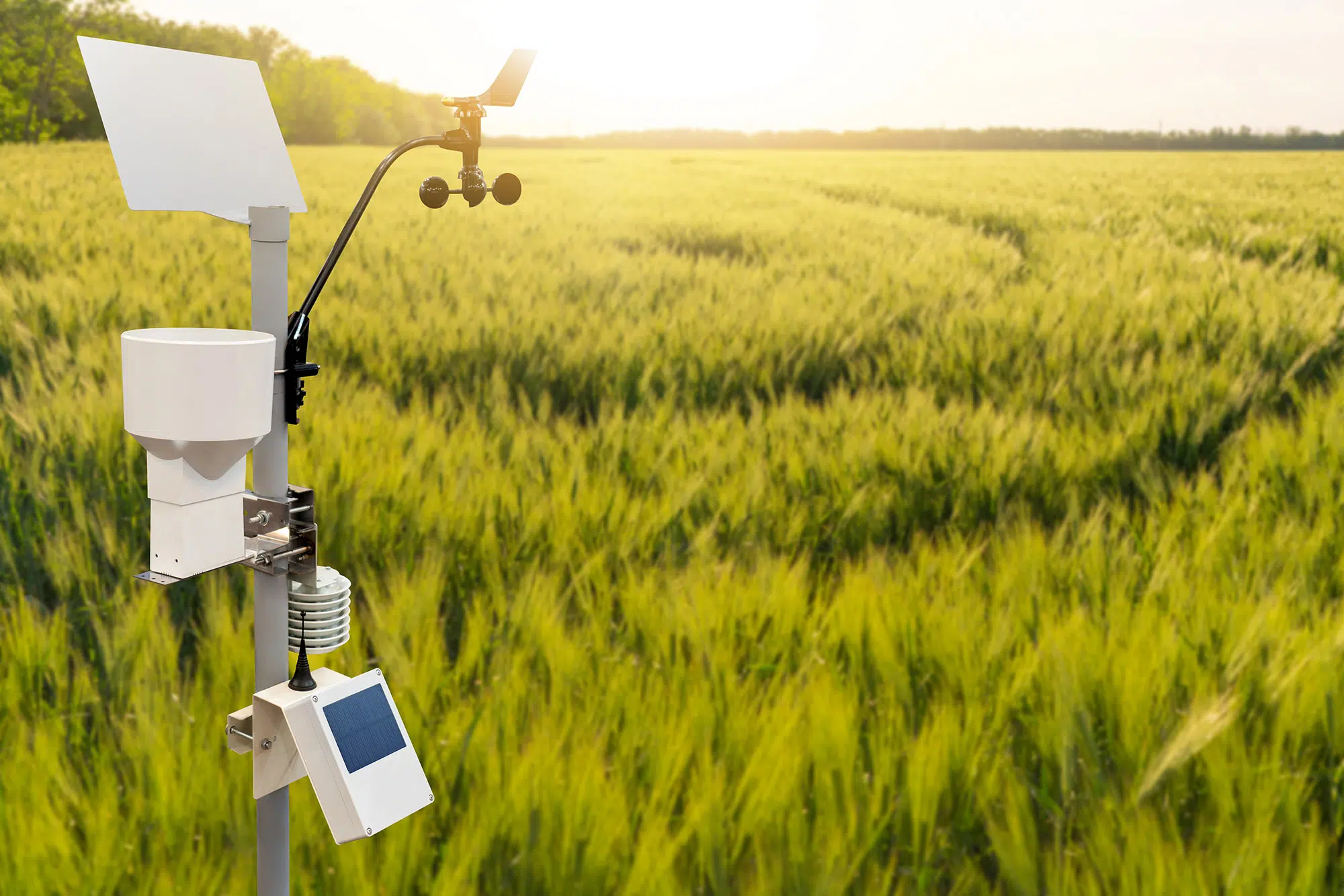
- IoT Field Sensors: Capture critical data for accurate, automated management of soil, weather, and livestock.
- Automated Machinery & Drones: Provide aerial imaging for pest detection and streamline operations.
- Digital Farm Management Platforms: Integrate live field data, satellite imagery, and advisories for data-based operations and recommendations.
- Precision Farming: Data aggregation for real-time monitoring of soil conditions, crop health, and weather patterns
- Livestock Management: Remote tracking and health monitoring
- Resource Optimisation: i.e. Precise irrigation and input/output management
- Supply Chain Tracking: Enhanced traceability and location of assets
- Vehicle videos, tracking, optimisation, security and safety
- Lone or vulnerable worker support via communications
- Remote Monitoring and property surveillance through alarms and CCTV
Practical Implementation Guidance for On-Farm Connectivity
Site and Need Assessment
Before implementing LEO satellite connectivity, agricultural operations should assess:
- Sky visibility and potential obstructions (trees, buildings, terrain) for the preferred location(s).
- Power availability and stability at installation sites – The need for UPS or back up support.
- Current bandwidth requirements and future growth projections.
Hybrid Deployment Strategies
For optimal cross site results, consider a hybrid approach:
- Use CSL Satellite (LEO) as primary connectivity for business systems and where needed for remote field locations.
- Deploy CSL dual-WAN routers to combine LEO with existing 4G/5G connections with suitable antennae where possible, or to extend range.
- Implement quality of service (QoS) and segmentation policies across the Wi-Fi to prioritise critical applications and the various types of users and use cases.
- Maintain fixed-line connections where available as primary links or as a failover.
- Utilise LPWAN (if available) for battery critical devices that are difficult to supply power to, or access.
Future Outlook
As technology evolves, several further developments are anticipated:
- Continued improvements in satellite technology and performance
- More integrated, flexible connectivity services that combine cellular and satellite availability
- Better spectrum management and increased capacity for all networks that will help serve some rural areas.
Conclusion
LEO satellite technology represents more than just a connectivity service—it is a catalyst for agricultural digital transformation. By providing reliable, high-speed internet to even the most remote farming regions, this exciting technology can make possible unprecedented levels of efficiency, sustainability, and productivity.
Agricultural businesses should proactively explore LEO satellite technologies, understanding that connectivity is no longer a luxury but a fundamental requirement for modern, competitive agriculture. A strategic, multi-technology approach that combines CSL Satellite (LEO) with complementary service offerings, provides the best path for bridging the rural digital divide. Driving, improved productivity, enhanced sustainability, and greater economic viability.